Location of Roswell UFO Crash

May.23.2007
The actual Roswell ufo crash site...
...is still up in debate as mystery has always surrounded this story from 1947. There are varying locations, but are within miles of one another. All alleged sites are west of highway 285 north of Roswell, so it can be sure of that.
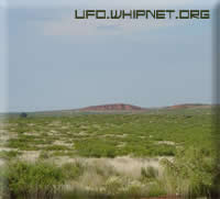
Here you will find directions for several sites mentioned in this article as well as a strange find on Mac Brazel's Ranch.
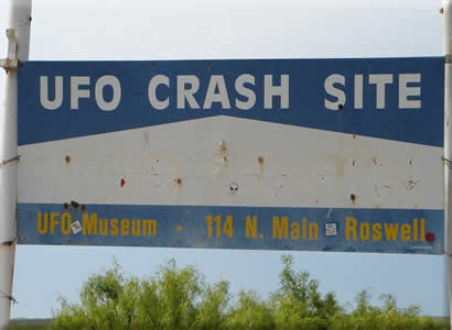
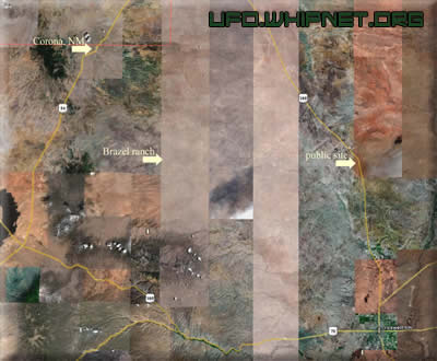
The first and as shown above is the public site. Our friends at myufo.com state that it is located 18 miles north of Roswell and is where the museum was allowed to go for the public 50 year anniversary. (No word on a 60th anniversary gathering 07/07/07.)

-Click above image for full view-
The ranch of Mac Brazel is no longer there. It is on Bureau of Land Management property, which is open to the public but reaching the site requires passing through private ranch land. Ownership of the private land is unknown.
Never being there personally, I relied on the directions below to try to find the ranch on Google Earth. Using its distance tools, I traveled from Corona east on 247 for 17 miles, turned right and traveled about 16 miles. To my surprise I found an airfield runway about a mile long.

I am not sure why there would be an airfield and a large complex in the location of the crash site. I might be completely off target too, so if anyone can provide anymore information about this, please contact us here at ufo.whipnet.org.
Here are directions to locations of 3 alleged crash sites.*
RAGSDALE SITE: Four-wheel drive required. From US 285 turn west on
Pine Lodge Rd. end travel 45 miles. Just past Mile Marker 33 is a sign for Boy Scout Mtn. Turn onto Forest Rd. 130 and drive 3.7 miles. Turn left onto a jeep road and drive a little more than a mile. You will cross a creek, climb a hill and see a stone campfire ring on the left at the crest of the hill. Follow a short trail to the rock, which is about 5 feet tall and is split in two.
BRAZEL SITE: From Corona, go east on NM 247 and just past Mile Marker 17, turn right at the Corona Compressor Station sign. The site is
about 16 miles southeast of the turnoff. It is on Bureau of Land
Management property, which is open to the public but reaching the site
requires passing through private ranch land, which is fenced and gated.
CORN SITE: Drive north from Roswell on US 285. You will see a large
sign advertising the crash site on the west side of the road about 20
miles north of town. The site sits about eight miles from US 285 on
private land. It is closed to all but organized tours.
~~~~~~~~~~~~~~~~~~~~~~~~~~~~~~~~~~~~~~~~~~

*These directions come from Glenn Campbell from ufomind.com. No one at ufo.whipnet.org has verified them. Please use with caution.
|

